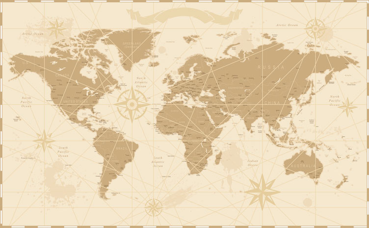

If history answers the when and philosophy answers the why, then geography answers the where.
Geography is a broad-ranging inter-disciplinary field that explores the interactions between humans and their environment, and it melds perfectly with a broader liberal arts curriculum.
Geography reveals the crux of resource wars that took place a thousand years ago just as accurately as it can reveal current threats to the environment through issues like climate change and natural resource depletion.
Today, both governments and industry place a premium on getting a big-picture perspective that encompasses the breadth of human and environmental factors. Liberal arts grads who have incorporated geography courses in their studies are in a unique position to understand that perspective.
What is Geography? … Spatial Science, Environmental Science, Social Science, and More
 Geography is a broad interdisciplinary field of study that looks at the connection between humans and the physical world; the inter-connectivity between people and places.
Geography is a spatial science. It’s much more than just memorizing the capitals of countries. Geography examines what makes any one place unique, looking at details like:
- Vegetation and soil type
- The people who live there and their cultures
- Location coordinates
- Climate type
Geography studies the land and its relationship with people from every imaginable aspect, including culture, geology, demographics, climate, politics, and much more. This makes geography an ideal subject to study as part of a broader liberal arts curriculum.
There are many aspects to geography. It can be descriptive and predictive…
Descriptive geography examines what an individual locale is like and what defines it.
Predictive geography seeks to identify patterns that allow for accurate predictions based on a common set of variables. For example: seaports at the equator will likely experience a tropical climate. Or, higher levels of CO2 in the atmosphere will likely mean higher global temperatures.
The Three Main Sub-Fields of Geography
Human Geography – this includes cultural studies, urban geography, economic geography, land use planning, and transportation geography.
Physical/Environmental Geography – this branch of geography includes climatology, geomorphology, and biogeography. Climatology is the study of the earth’s climate in the past, present, and future based on predictive models. Geomorphology is the study of physical features on the earth and their relationship with the underlying geology. Biogeography is the study of the geographic distribution of animals and plants.
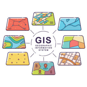
Technical Geography – this refers to the application of modern technology to the study of geography. Principally this includes Geographic Information Systems (GIS) technology, remote sensing based on analysis of satellite and aerial photography, and surveying.
With implications for the understanding of climate change, agricultural productivity, immigration patterns, and land potential, the importance of studying geography within a liberal arts context is clearly illuminated.
The Ogallala Aquifer Offers a Fascinating Geographic Case Study with Some Alarming Findings
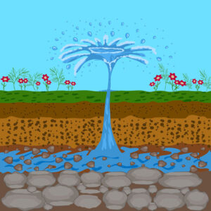
 Situated under the Great Plains and encompassing the territory of eight states –South Dakota, Wyoming, Nebraska, Colorado, Kansas, New Mexico, Oklahoma, and Texas– the Ogallala Aquifer is one of the largest in the world.
Bringing water to kitchen sinks, bathrooms and lawns in cities and suburbs across the Great Plains region, the Ogallala Aquifer also provides water for more than a quarter of all irrigated land in the nation, notably including several states where agriculture is the primary industry.
And this aquifer is being quickly depleted; once it runs out, it’s projected to take 6,000 years to replenish based on natural rainfall rates.
The reasons why this aquifer is in danger are complex. And these reasons present a case study that exemplifies the inter-disciplinary nature of geography and how this field encompasses the full breadth of the relationship between humans and the environment. To understand the implications of the depletion of the Ogallala Aquifer, geography considers all of the following:
- Post-World-War-Two population growth in the United States that caused more people to live in the Great Plains.
- Post-War agricultural expansion and the political environment up through the end of the Cold War that favored the United States placing an emphasis on agriculture and food-independence.
- The geology of the Great Plains and how this contributes to future predictions about aquifer depletion and regeneration.
- Current trends in Great Plains urban and rural growth, population growth, and the growth of the agricultural industry.
- Proposed and existing environmental legislation that affects water use and land management.
- Data from satellites about average temperature and rainfall rates in the Great Plains.
- The culture of the people that live in the Great Plains and how this could affect population growth and water usage.
A Diversity of Careers are Found in the Field of Geography
 According to the US Department of Labor, most geographers (71%) work for government agencies: 63% with the federal government and 8% with state governments. This is followed by:
- 14% of geographers who work at colleges and universities
- 3% who work as consultants in the technical, scientific, and management sectors
- 3% who work in engineering and architectural-related services
The range of career fields and jobs within the discipline of geography are noteworthy for being broad and diverse, including:
- Travel writer
- Environmental journalist
- Land management professional
- NGO and non-profit work
- Public health professional
- Environmental planner
- Research, design, and engineering professional
- Environmental scientist
- Environmental impact statement writer, hazard researcher, or consultant
- Tour guide
- Geodesic surveyor
- Travel agent
- Demographer
- Site selection analyst/scout for businesses
- Intelligence analyst for the CIA
- Resource analyst
- GIS specialist
- Professor at a university
- Market research policy analyst
The US Department of Labor identifies a bachelor’s degree as being the entry-level qualification for geographers, with more advanced positions typically requiring a master’s degree combined with relevant work experience. It states that outside of federal employment, a master’s degree may be the typical qualification that private employers are looking for.
The DOL also reports that a PhD is often required for the top research positions in this field, and that GIS proficiency will give geographers an important competitive advantage in today’s technologically-heavy marketplace. In general good computer skills are a huge attribute in this field.
The public sector, academia, and multicultural private employers all place a high value on a well-rounded and culturally-cognizant liberal arts education. The quintessential interdisciplinary field, geography additionally incorporates foundational liberal arts fields like cultural studies, history, economics, and the social sciences. This is why the study of geography fits perfectly within a broader liberal arts backdrop.
2020 US Bureau of Labor Statistics job market trends for Geographers based on national data, not school-specific information. Conditions in your area may vary. Data accessed January 2022.
Geographic Information Science – The Hottest Job in Geography
 Like so many other fields, advances in computer technology have made GIS jobs some of the hottest fields in geography.
Data presentation in the form of charts and graphs is already increasingly valued in this field. But this is quickly overshadowed by professionals who are fluent in the latest GIS programs, both in terms of hardware and software. Today’s GIS technology offers superior performance in realms like mapping, data modeling, geostats, map-overlays, and networks.
If you want to be competitive in this niche of geography then you should be familiar with these GIS platforms:
- Surfer – The archetypal program for rendering geo-spatial data with graphical representations of everything from elevation contours to hydrology, watershed drainages, and returned LIDAR values. Knowledge of Surfer is a basic pre-requisite in this field.
- ArcGIS – Developed by ESRI, this tool is topology-focused and includes 2-D and 3-D environmental modeling. It’s capable of processing large amounts of data to return realistic outputs.
- Maptitude – This platform stands out for the ease of which it lets users integrate, edit, and consume maps. Its unique location geocoding mechanism has been refined for over two decades since its original release in 1995. Today Maptitude is recognized as a data and demographic wizard.
Improvements in technology are revolutionizing many fields that benefit from computerization. When it comes to geography this simply represents another step towards progress. Advancements in the understanding of the relationship between people and their environments is what defines progress in geography, and it also explains why the study of geography is perfectly rooted within a wider liberal arts context.


